
Overview
During early exploration, particularly in ‘greenfield’ areas away from mines or known mineralisation, very little information is known about the rocks. If an exploration company has the budget to drill a few holes and conduct an airborne or ground geophysical survey, they can add value to a project by also collecting downhole geophysical data.
What is Downhole Geophysics?
Geophysical surveys provide information about the physical properties of rocks, such as their density, magnetic properties or electrical conductivity. Explorers undertake geophysical surveys from the air using a plane or helicopter, or from the ground using an array of sensors and vehicles on land, or by sending geophysical probes down a drill hole.
Downhole, or borehole, geophysical surveys measure the physical properties of rocks along a subsurface drill hole. Explorers use drill holes to collect core or rock chips, to ‘map’ the rock types down the hole and often send rock chip samples for geochemical analysis.
To extract the most value from a drill program, it’s best to also do a geophysical survey of the hole to measuring the physical properties of the rocks in place. This is usually only possible at the time of drilling before a drill hole collapses or is closed.
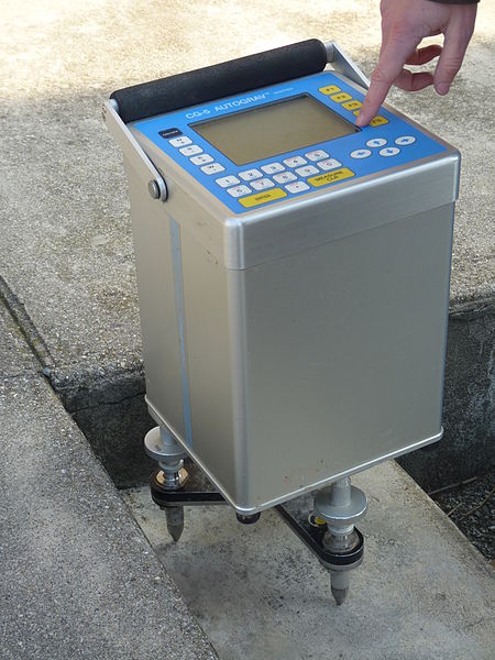
The Equipment
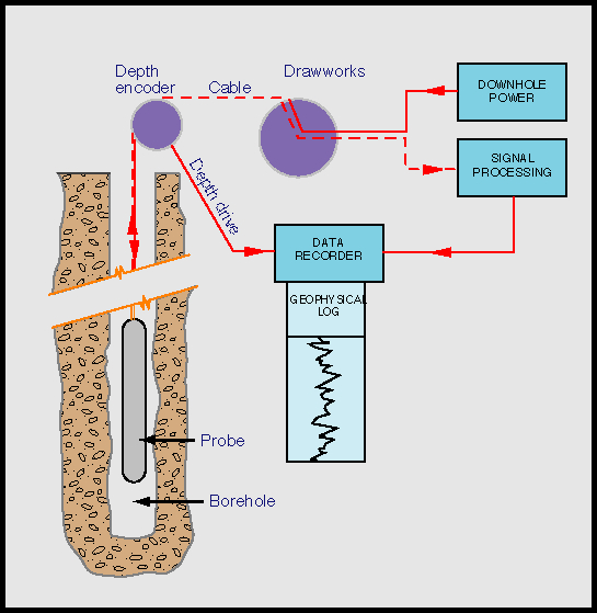
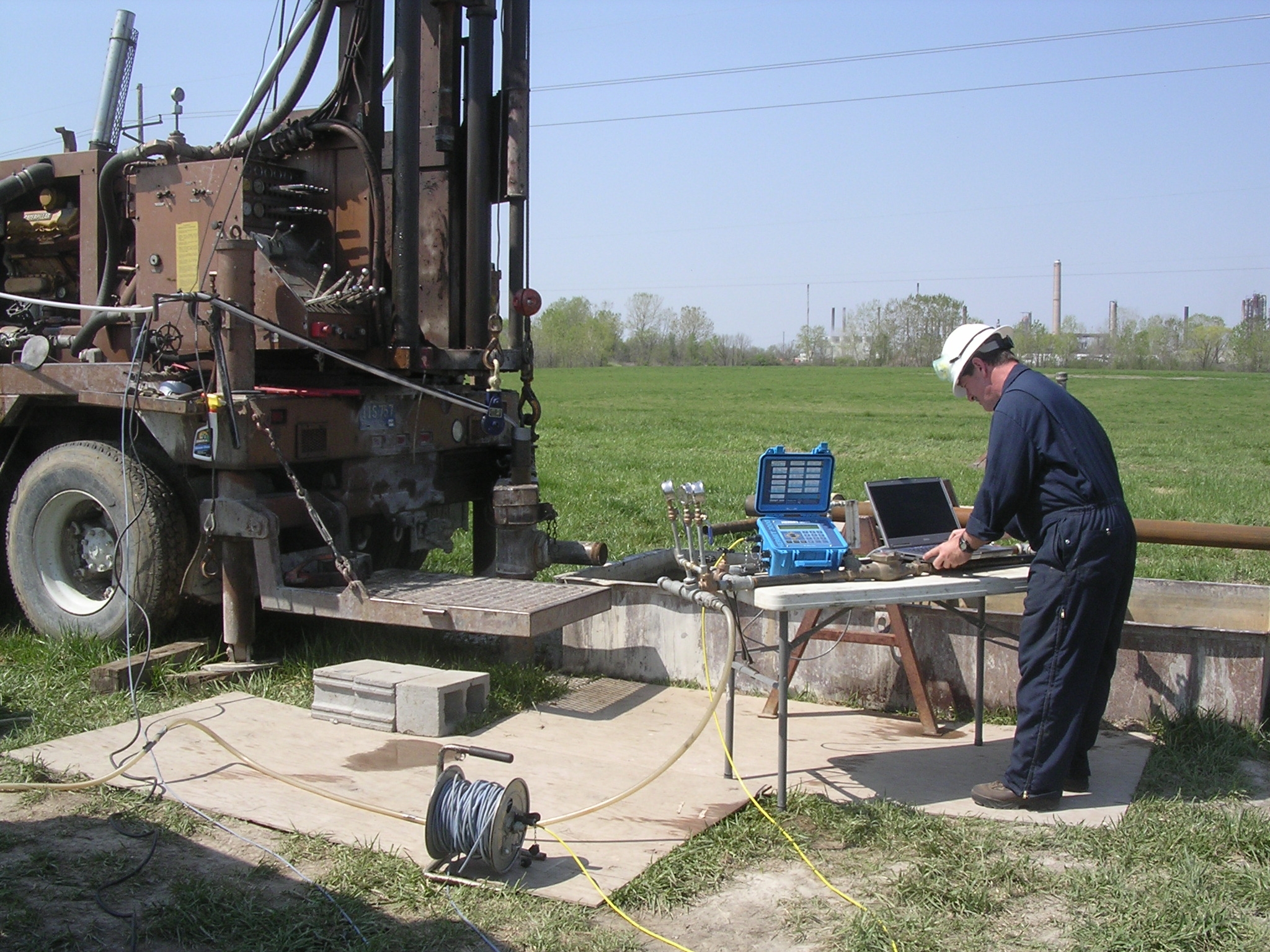
Most downhole geophysical surveys involve sending a long, thin probe attached to a wire cable down the completed drill hole. Each probe usually contains an energy source or transmitter and a recording sensor.
The system is operated by a geophysical contractor and the procedure requires cooperation from the drill operators because some of the drilling equipment usually stays in the hole to keep it open. This adds to the expense of doing downhole surveys, which is why they are not typically used on every drill hole.
In most cases the probe sends information up to the surface in real-time, either wirelessly or via the cable. A string of different probes can be connected to collect more than one type of geophysical information.
Small Details, Big Picture
This data not only provides information about the rocks directly intersected by the drill but can shed light on the rocks up to a few hundred meters around the hole, potentially identifying ore zones that were narrowly missed by the drill hole. The data can also be used to tighten up the reliability of 3D geophysical models over the entire claim area.
Down-hole geophysical surveys are incredibly valuable because they directly measure properties that are usually only implied by complex modelling of data collected at surface.
Types of Downhole Surveys and What They Tell Us
Many factors contribute to the physical properties of a rock, including its formation history, how densely packed the minerals are, the types of minerals present and how they have been altered.
The most common properties measured include:
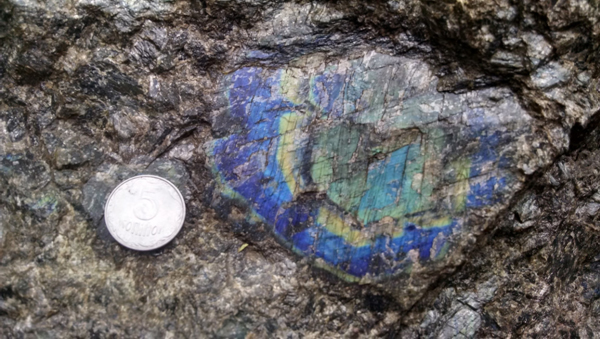
Density
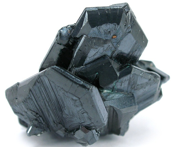
Many ore minerals, including metal-sulfides such as galena, bornite, chalcopyrite and pentlandite, and oxides like chromite, are dense compared to the rocks they are found in. In addition, many of the alteration minerals associated with ore minerals are also dense, including pyrite, magnetite, hematite, and pyrrhotite.
Downhole density surveys use a probe containing a radioactive source to identify zones containing dense minerals. The probe sends out gamma rays that bounce back off the electrons in the surrounding material.
Dense materials contain more electrons and reflect more gamma rays, indicating areas of denser material that could indicate the presence of ore minerals. Density probes measure the density of the materials immediately intersected by the drill.
Gravity
A downhole gravity survey identifies high density rock formations within a few hundred meters of the drill hole by detecting changes earth’s gravity. The strength of gravity is directly related to the mass of a rock feature and its distance.
Massive sulphides, chromite ore, iron ore, some stock-works and barite (barium sulfate) deposits are some of the ore materials with high mass that can be mapped by gravity surveys. Mafic intrusions and basaltic volcanic rocks are also readily mapped with gravity surveys.
A typical gravity probe measures the gravitational ‘pull’ on a sensor as it travels down the hole. This gravity meter detects changes to identify zones of extra pull. Several gravity surveys in a number of drill holes may be needed to pinpoint the location of a gravity anomaly.
Magnetic Susceptibility
Magnetic susceptibility measures how a rock responds to the earth’s magnetic field and reflects the amount of magnetic minerals, mainly the mineral magnetite, present in the rock. Few ore minerals are actually magnetic but other magnetic minerals are common in alteration zones including the iron oxides e.g. hematite, maghemite, limonite, and some sulphides such as pyrrhotite.
Downhole magnetic susceptibility probes inject a voltage into the surrounding rock and record the strength of the magnetic response produced by the rock. The more magnetic minerals a rock contains, the more susceptible a rock is, so the stronger the response to the voltage.
Downhole magnetic field surveys provide an alternate view of the magnetic properties of the rocks around the drill hole. They measure the strength of the magnetic field associated with the rocks which is a combination of the magnetic susceptibility and the remnant magnetisation of the rocks. Remanent magnetisation is the magnetic field preserved or ‘frozen’ at the time the mineral formed or when it was last heated, recording the orientation of the earth’s magnetic field at that time.
Magnetic field surveys penetrate further from the drill hole but only provide an indirect estimate of the actual magnetic susceptibility and several surveys in a number of drill holes may be required to locate a magnetic anomaly.
Electrical Properties
Explorers use various direct current (DC) induced polarisation (IP) survey methods to study the electrical properties of rocks.
A downhole DCIP probe injects an alternating current directly into the rocks, usually two seconds on and two seconds off. The voltage response of the rocks is measured with electrical receivers at the surface or at the other end of the downhole probe. While the current is on, it measures how well – or poorly! – the current flows through the rock and records a voltage associated with conductivity or resistivity of the rock.
When the current is switched off, it measures how quickly the rock releases the charge it stored up when the current was on, by recording a voltage associated with the chargeability of the rock.
Conductivity
Rocks and minerals that allow an electrical current to flow through them are known as conductors. Conductivity depends on rock type, porosity, fluids, and, most importantly for mineral exploration, the metal content of rock.
Veins, stingers, or massive sulfide bodies of copper or nickel ore are some of the best conductors, with the connected sulfide minerals acting like an electrical wire. Other conductive minerals include magnetite, specular hematite, carbon, graphite, pyrite and pyrrhotite.
Resistivity
The opposite – or inverse – of conductivity is resistivity. Resistive rocks conduct electricity poorly. Silicate minerals, like quartz, are highly resistive, so have low electrical conductivity.
Identifying rocks that don’t conduct electrical current can be just as important and the ones that do. Areas of electrical resistivity often identify zones of alteration such as the silicic alteration in the core of porphyry deposits.
Chargeability
Downhole IP surveying tools can also measure the chargeability of a rock which is its ability to hold on to a charge, like a battery. Rocks with common, but disconnected blobs of sulfides have the largest chargeability responses.
The sulfide minerals store up electrical charge while the injected current is on, but struggle to dispel that charge because they are surrounded by more resistive minerals on all sides. Copper porphyry and some low grade nickel deposits are ideal chargeability targets.
EM
Electromagnetic (EM) surveys also measure conductivity and resistivity, but they do so by transmitting an electric field into the rocks, which is converted into a magnetic field by conductive rocks and minerals. The probes then measure the strength of that induced magnetic field.
Downhole EM (DHEM) surveys help to locate strong conductors like nickel and chrome or massive sulphide ore bodies situated some distance away from the drill hole.
Other Survey Tools
Sending cameras down drill holes to record still images and even video of the rocks in place is becoming more common.
Often directional tools are part of the string of probes to be sent down the hole to precisely measure the depth and orientation of the hole.
There are also tools to measure radioactivity – levels of uranium (U), thorium (Th) and potassium (K) – down a drill hole.
Further reading
Abitibi Geophysics has a great website with lots of detail about various geophysical methods
The Geophysical Inversion Facility at University of British Columbia has a series of pages explaining the physical properties of rocks in depth
This older USGS publication provides a good overview of downhole geophysical methods
Subscribe for Email Updates

Pingback: Hunting for Giants: An Introduction to ZTEM Surveys in Mineral Exploration | Geology for Investors