The company’s diverse property holdings and target commodities provide them with a sort of hedge against relying too much on the price and sentiment associated with any one metal.
[box type=”info” align=”aligncenter” ]Disclaimer: This is an editorial review of a public mining company press release and is not an endorsement. It may include opinions or points of view that may not be shared by the companies mentioned in the release. The editorial comments are highlighted so as to be easily separated from the release text and portions of the release not affecting this review may be deleted. Read more at How to Use this Site.[/box]
QUEBEC CITY, QUEBEC–(May 13, 2014) – Virginia Mines Inc. (“Virginia”) (TSX:VGQ) is pleased to release the results of its drill campaigns carried out in winter 2014 on its Wabamisk and Coulon properties both located in the James Bay region.
WABAMISK PROPERTY
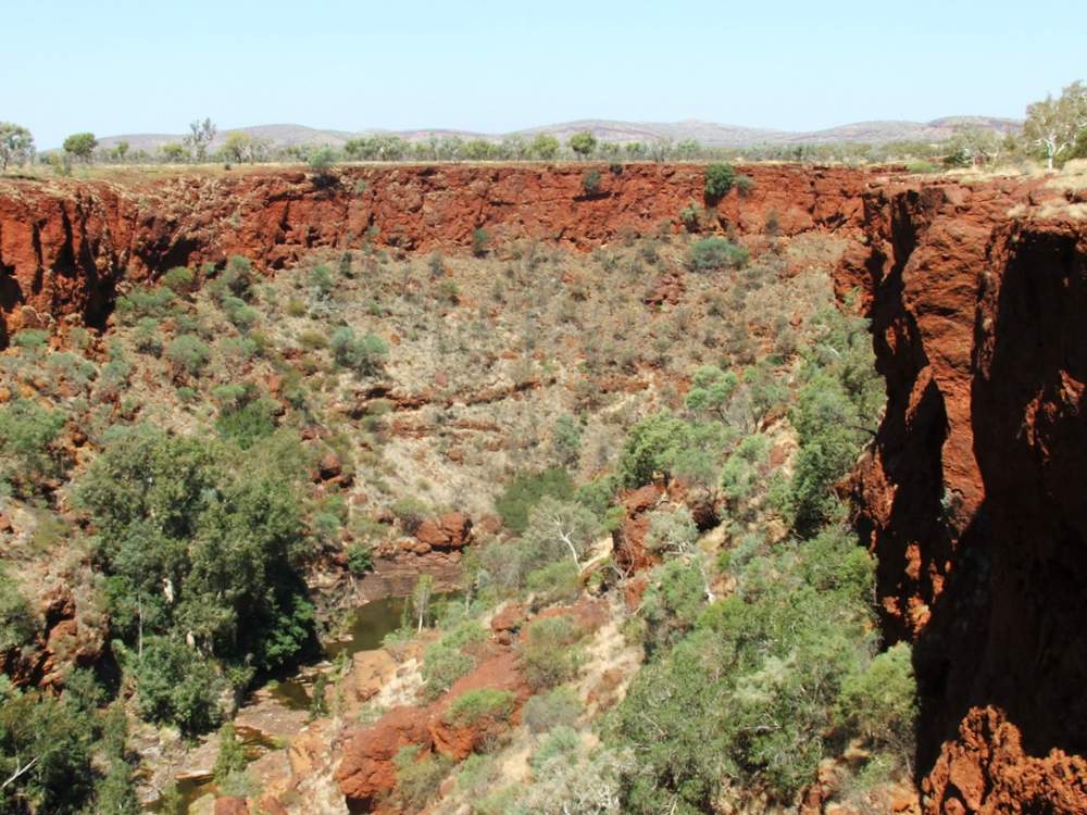
In winter 2014, Virginia carried out a drill campaign on its Wabamisk property located in the region of the Opinaca Reservoir, on the James Bay territory. The property consists of 1,004 designated claims covering a surface of 527 square kilometres within the Eastmain Achaean volcano-sedimentary belt.
[box type=”note” align=”aligncenter” ]
With a large and diverse property portfolio (11 Gold and 8 Base Metal properties), Virginia Mines is one of the larger exploration players active in the James Bay region of northern Quebec, Canada. The company’s diverse property holdings and target commodities provide them with a sort of hedge against relying too much on the price and sentiment associated with any one metal.
The company is well funded with a recent private placement of $8.4 million and regular advance royalty payments from its 2006 sale of the Eleonore property (now known as The Roberto Deposit) to GoldCorp.
[/box]
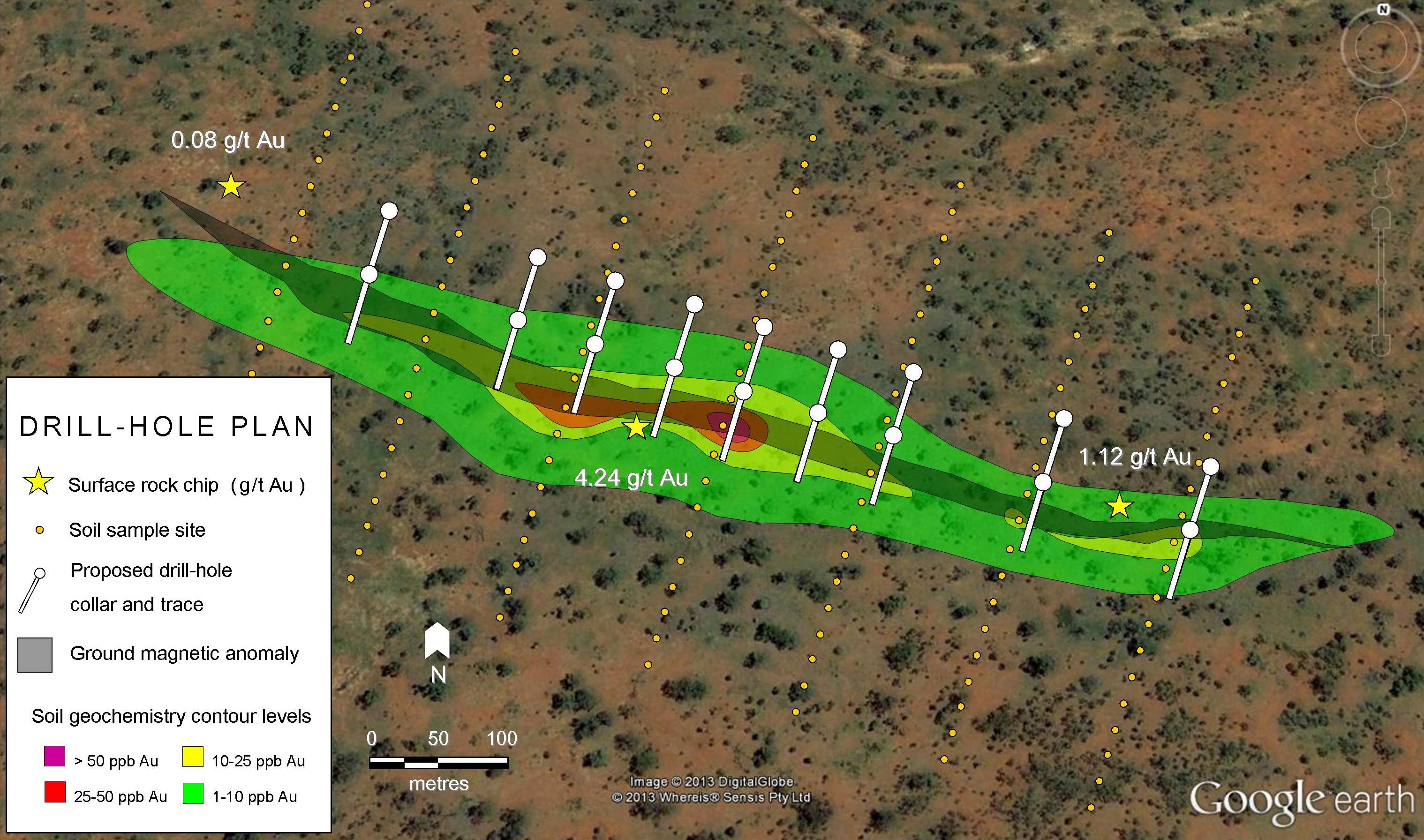
Drilling consisted of 15 new holes (WB-14-030 to 044) and the extension of two former holes (WB-13-016Ext and WB-13-025Ext) for a total of 3,210 metres. Work aimed at testing the vertical continuity of the Mustang Vein and of other showings of the main stripping area to depths of 125 to 250 metres beneath the surface. Some holes also tested at shallow depth the extension of the new Challenger and Interceptor gold showings discovered in summer 2013 as well as a geological target in the east portion of the Wabamisk grid.
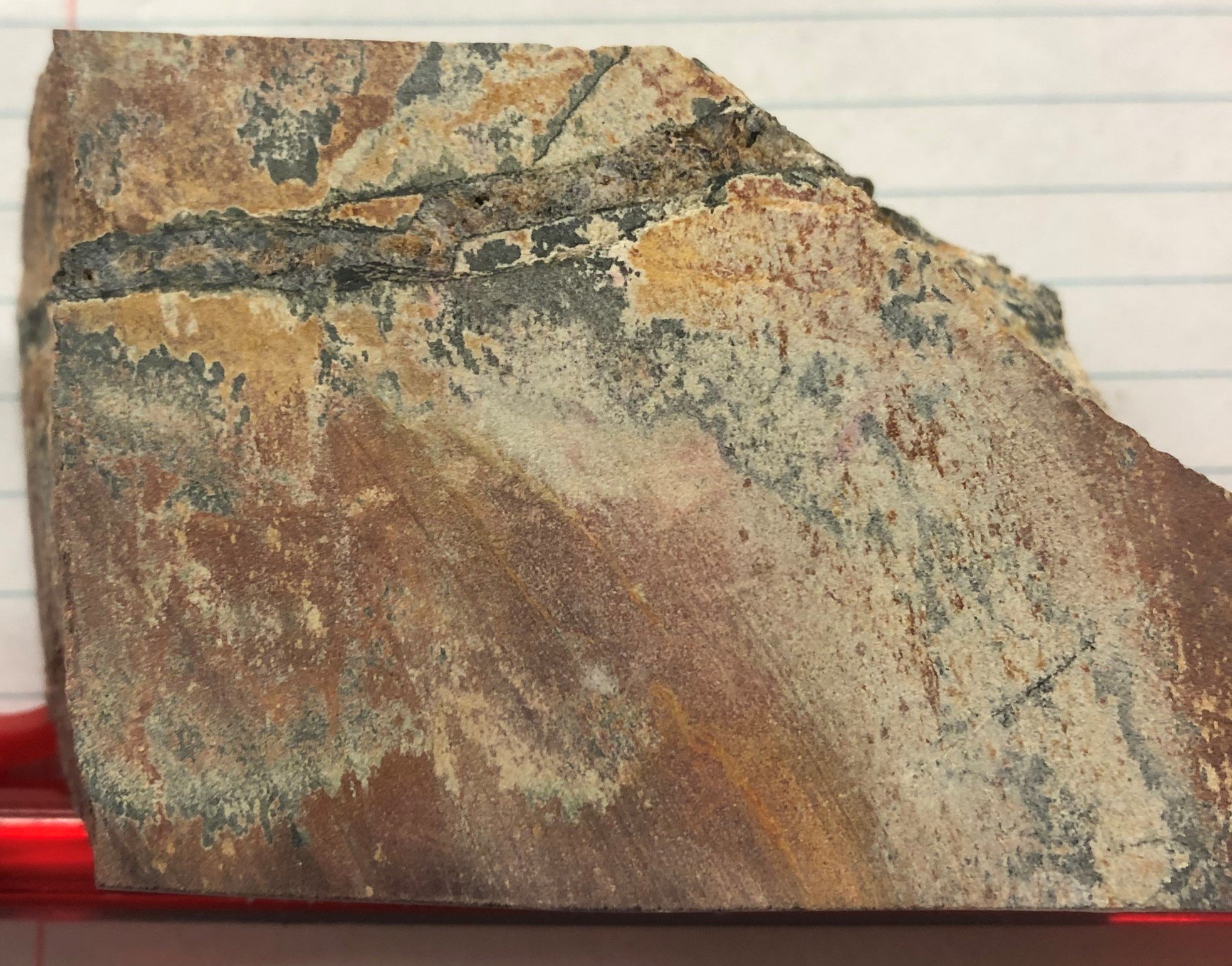
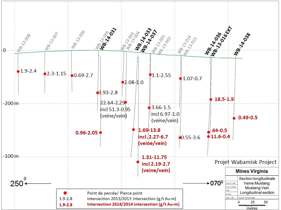
In the main area, drilling confirmed the vertical continuity of the Mustang Vein down to a depth of about 250 metres and also extended its lateral extension to the east over a distance of 150 metres or so. Given the free and coarse nature of gold in the Mustang Vein, drilling returned varying results but two sectors yielded better values overall. The gold structure is well developed in the inflexion zone of the Mustang Vein where holes WB-14-033 and WB-14-037 crosscut mineralized intersections of decametric thicknesses. The Mustang Vein, which reaches over 6 metres, lies within a plurimetric envelope of highly altered and mineralized meta-wackes (quartz-sericite-tourmaline-biotite-chlorite-arsenopyrite-pyrite). Hole WB-14-033 returned a mineralized intersection grading 1.69 g/t Au over 13.8 metres, including 2.27 g/t Au over 6.7 metres in the Mustang Vein. Hole WB-14-037 yielded 1.31 g/t Au over 11.75 metres, including 2.19 g/t Au over 2.7 metres in the Mustang Vein. Visible gold was observed in the vein in hole WB-14-033. These intersections are located under hole WB-13-004, which returned 22.64 g/t Au over 2.25 metres in the Mustang Vein. The vein remains totally open at depth in this area. Interesting results were also obtained in the newly defined extension of the Mustang Vein towards the east. Hole WB-14-036 confirmed the continuity of the Mustang Vein under thick overburden with an intersection grading 18.5 g/t Au over 1.9 metres. The vein hosts grains of visible gold. The vertical extension of this intersection was tested and confirmed by the extension of hole WB-13-016, which crosscut two quartz veins grading 64.0 g/t Au over 0.5 metres and 11.6 g/t Au over 0.4 metres. Visible gold was also observed in these two veins. The gold structure remains entirely open at depth and its lateral continuity to the east is confirmed by hole WB-14-038.
Drilling carried out in the main area also confirmed the presence of several other parallel gold structures that appear to develop to the north of the Mustang Vein. The network of veins and veinlets so far remains little tested but it returned several interesting intersections comprising, in particular, 39.05 g/t Au over 0.9 metres (WB-14-034), 3.61 g/t Au over 4 metres (WB-14-036), 5.24 g/t Au over 2 metres (WB-14-039) and1.73 g/t Au over 7.4 metres (WB-14-037), in 2014, as well as 1.98 g/t Au over 13.4 metres (including 4,14 g/t Au over 4 metres) (WB-13-015),6.02 g/t Au over 3.2 metres and 18.05 g/t Au over 0.8 metres (WB-13-025) in 2013. Many of these intersections may be correlated together, suggesting a good continuity of these gold structures. Closely-spaced grid drilling will be needed to test this interpretation. These gold structures clearly remain entirely open laterally and at depth.
[box type=”note”]
Like many gold deposits in this region, the gold is structurally hosted along planes of weakness created by large scale tectonic shifting. This shifting produces faults and folds which create channels for metal-bearing hydrothermal fluids. The Roberto deposit has a similar geologic signature (formed within sedimentary rocks) that aids the exploration by providing a reference. Virginia Mines no doubt hopes with the Wabmisk property will be another Roberto Deposit (located 65km away).
There’s a lot of information here, but essentially the drilling has yielded promising results and has expanded the extent of the Mustang Vein. The company has also identified other minerals and rock textures that are associated with the gold-bearing structure and form an “envelope” around it. This will be useful in helping them define the extent of the mineralized system. Structurally hosted gold deposits are typically higher grade and confined to small to large (millimeter, to meter) scale veins. These narrow structures can be difficult to pinpoint and require careful drill planning.
[/box]
Elsewhere on the property, hole WB-14-042 confirmed at shallow depth the extension of the Interceptor showing with an intersection grading 22.9 g/t Au over 1 metre. The three other holes in the Interceptor-Challenger sector only returned anomalous values in metric thicknesses. It is to be noted that the Interceptor showing lies within an auriferous corridor situated four kilometres to the north of the corridor hosting the Mustang Vein, in the same sequence of folded sedimentary rocks.
[box type=”note”]
There are a lot of assay numbers in this release. Some of them are from last year’s holes and others are from a newer step out zone to the north of the Mustang Vein. The cross-section diagram below includes the drill results from this year and last on the Mustang Vein. Note that the first number is the interval apparent width and the second number is the grade. The company is estimating that the reported thickness is about 80% of the true thickness.
[/box]
Finally, the Wabamisk project also covers other gold corridors and sectors that have been somewhat explored thus far. Surface work including mechanical stripping, rock sampling and detailed mapping is planned for the coming summer. Work will target the CIT corridor (Challenger-Interceptor-Trailblazer) and its west extension, the west extension of the Mustang corridor as well as many other favourable sectors defined by previous work.Virginia is encouraged by the results of the winter 2014 drilling program. The vertical continuity of the Mustang Vein is confirmed down to a depth of 250 metres and its lateral extension is extended by 150 metres to the east where it remains entirely open in a sector covered with overburden. Notwithstanding the variability in results arising from the free nature of gold, drilling highlighted two sectors that gathered the best values in the inflexion zone and in the east extension of the Mustang Vein. Drilling also revealed the emergence of many other gold structures developed in parallel with the Mustang Vein. This network of veins and veinlets, which remains entirely open laterally and at depth, already returned interesting results despite the wide spacing of drilling. Based on these results, additional drilling is fully justified in order to pursue the evaluation of the Mustang Vein and of other parallel structures.
COULON PROPERTY
In winter 2014, Virginia completed an exploration program on the Coulon base-metal project. It is to be noted that the Coulon project is developed in partnership with SODÉMEX Développement, s.e.c. (“SODÉMEX”) (a subsidiary of Caisse de dépôt et placement du Québec),Fonds de solidarité des travailleurs du Québec (F.T.Q.), jointly with Fonds régional Nord-du-Québec, (collectively the “Fonds”) and SIDEX, s.e.c. (“SIDEX”). The current participation of each party is as follows: Virginia (89.8%), SODÉMEX (4.08%), le Fonds (4.08%) and SIDEX (2.04%). The project is located 15 kilometres north of the Fontange airport and consists of 498 designated claims covering a surface of 247 square kilometres.
[box type=”note” align=”aligncenter” ]
Logistics can become a huge problem in remote northern areas especially when a prospect begins to move to more advanced exploration or mine development. Moving equipment and people can be costly if the right infrastructure isn’t in place. Luckily for Virginia Mines the Coulon Property is right next to an airport. Although flying is always expensive, this is a definite advantage for the company during early exploration. As the project advances infrastructure will become more of an issue. A base metal mine will require road, rail or a nearby harbour.
[/box]
The winter 2014 exploration program included a 15,678-metre drilling program as well as a component of ground and borehole geophysical surveys. Drilling aimed at testing the extensions of Lens 257, Lens 43 and Lens 201. In total, seven new holes as well as the extension of an existing hole were realized in the favourable horizon of Lens 257, while four holes were extended and two holes drilled in the favourable horizon of Lens 43-S. Two holes tested the north extension of Lens 201 while another hole was drilled in the area of Lens 16-17. Finally, seven short holes were drilled in the Spirit area while another three tested the favourable stratigraphy (see Coulon surface plan). As regards the geophysics, a ground geophysical survey of 112.4 kilometres (Infinitem) was carried out while 25 holes were surveyed with down-hole Infinitem.
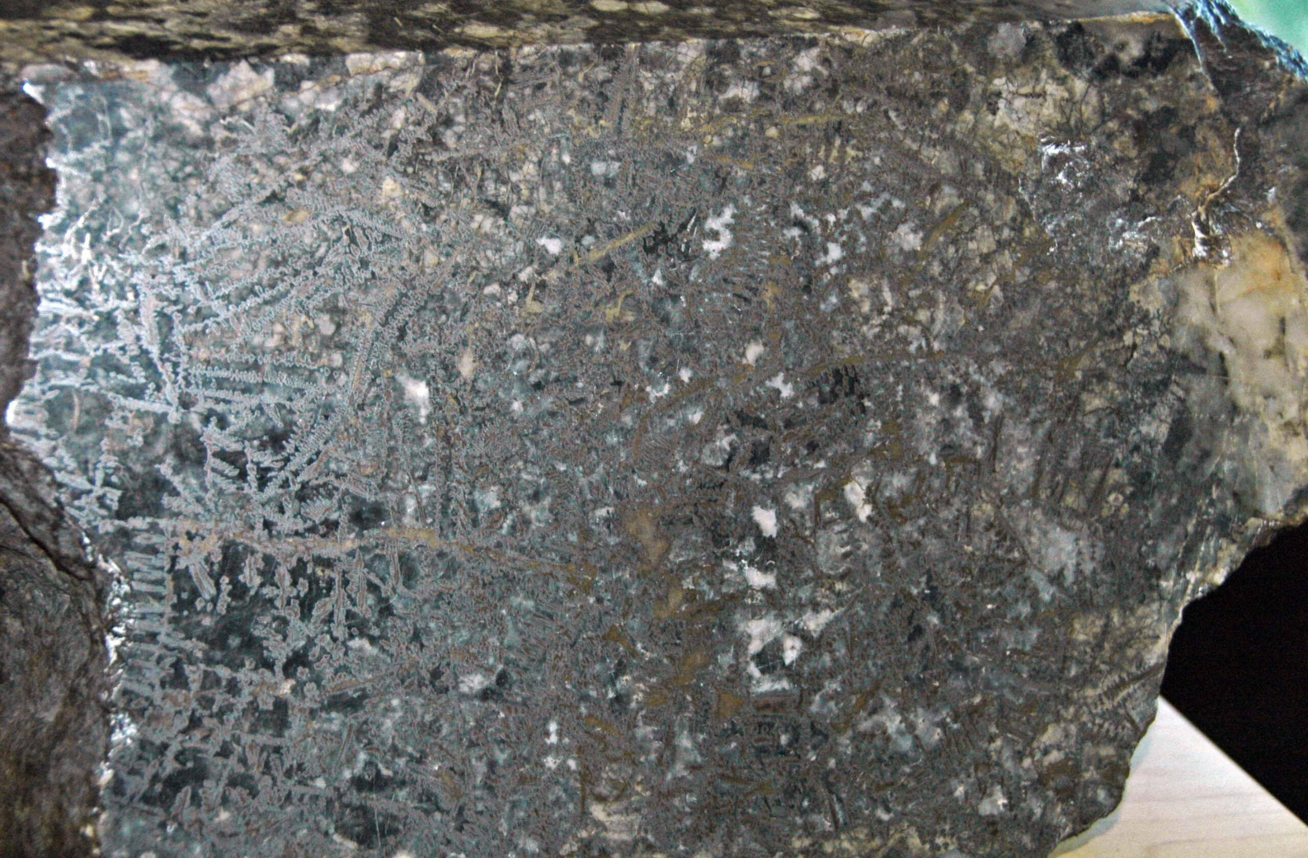
Most of the holes drilled in the horizon hosting Lens 257 intersected a fertile volcanic sequence characterized by strong hydrothermal alterations and by metric, disseminated to massive sulphide zones. The best values were obtained in the north-east extension of Lens 257 with results of 14.17% Zn, 1.47% Cu and 54.18g/t Ag over 3.9 metres in hole CN-14-276, and of 1.16% Zn, 2.52% Cu and 46.9 g/t Ag over 1 metre in hole CN-14-286 (see horizontal projection of Lens 257). Hole CN-14-278 and the extension of hole CN-08-214 missed the projected extension of Lens 257 to the north-east and, consequently, did not crosscut any significant mineralized zones. Furthermore, holes CN-14-278 and CN-14-286 intercepted a secondary mineralized horizon, which returned 1.91% Zn, 0.95% Cu and 22.94 g/t Ag over 2.7 metres and 3.05% Zn, 0.95% Cu and 36 g/t Ag over 5.8 metres, respectively. This horizon is likely to correspond to the horizon bearing Lens 08. The length of all these intersections is very close to the true thickness of the mineralized zones. Hole CN-14-290 testing the southwest extension of Lens 257 did not crosscut any significant mineralization. Holes CN-14-292B, CN-14-293 and CN-14-296B tested the horizon bearing Lens 257 more than 500 metres to the southwest of Lens 257. These holes failed to intercept significant mineralized zones; however, hole CN-14-296B revealed an interesting off-hole geophysical anomaly. This hole is located in the area of hole CN-11-242, which crosscut, along the same mineral-bearing-horizon, a mineralized interval grading 2.05% Cu, 0.72% Zn, 20.8 g/t Ag and 0.19 g/t Au over 11.2 metres.
[box type=”note”]
VMS deposits are well known for their high grade, low tonnage and deep ore bodies (relative to Copper Porphyry’s that are typically several hundred million tons, and near surface). The intercepts here are located anywhere from 500 to 950 meters at depth and therefore would require underground mining to extract. Something to consider if the company performs a pre-feasability study on the resource.
[/box]
These results confirm the northeast continuity of Lens 257, which is now followed over a lateral distance of over 415 metres, at a vertical depth varying between 550 to 850 metres beneath the surface. Lens 257 seems to appear as an elongated mineralized body in accordance with a northeast-southwest direction, dipping moderately to the northwest and plunging gently to the northeast. The lens remains open at depth and is partially restricted to the east by holes CN-12-272 and CN-13-267, and to the west by hole CN-13-269B. The southwest extension of the lens appears to be partly limited by hole CN-14-290. The mineral-bearing-horizon of Lens 257 remains unexplored over a segment of over 400 metres between hole CN-14-290 and the mineralized intersection of hole CN-11-242 previously mentioned.
In the area of Lens 43, the extension of four drill holes aimed primarily at testing the horizon of Lens 43 Sud, which had not been reached by these holes. The extension of holes CN-07-099 and CN-07-107C intercepted strong hydrothermal alteration zones associated with the horizon 43-S while the extensions of holes CN-08-180 and CN-08-182 did not crosscut alteration or significant mineralization. However, an off-hole anomaly was detected at the tip of hole CN-08-180. Two new holes were also drilled in the area of Lens 43. Hole CN-14-291 targeted the extension of Lens 43-S towards the surface and only intercepted alteration while hole CN-14-279 tested the south hinge zone of Lens 43. This hole did not intercept mineralization but an interesting off-hole anomaly was detected on top of this hole to the south.
[box type=”note” align=”aligncenter” ]
Although many of the drill holes failed to intersect significant mineralization, the drilling should not be considered a complete waste. Massive sulphides are excellent conductors, and could provide easy targets for geophysical surveys. The company may want to perform borehole geophysical surveys after drilling is completed to target conductive bodies at depth.
[/box]
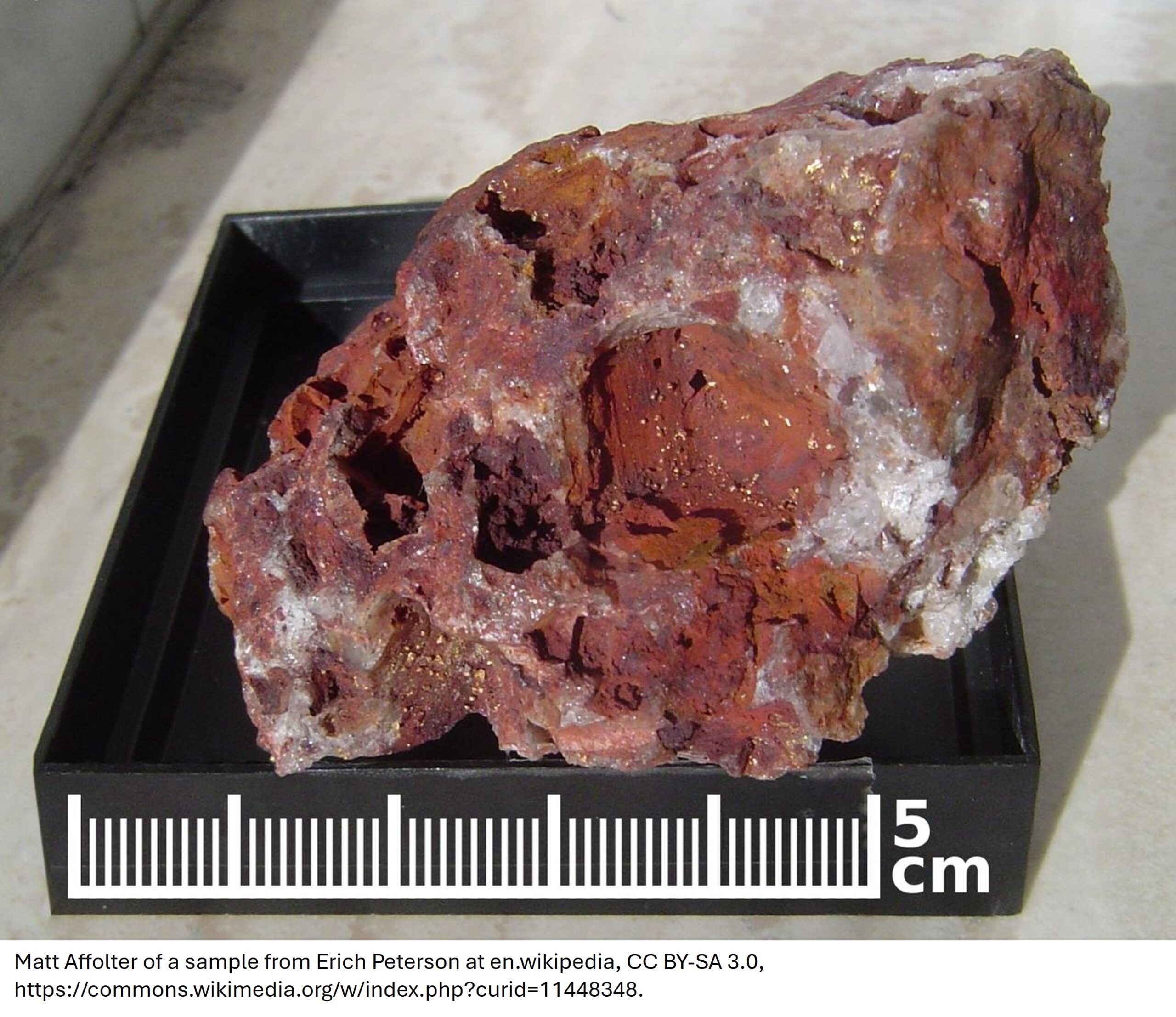
A hole was drilled in the area of Lens 16-17 with the goal of extending towards the surface the mineralization obtained in hole CN-11-223, which returned values of 3.86% Zn, 0.7% Cu and 75.09 g/t Ag over 44 metres. Hole CN-14-289 crosscut a semi-massive sulphide zone of over 5 metres in thickness, which returned values of 1.13% Zn, 1.18% Cu and 77.22 g/t Ag over 3.35 metres.
Two holes tested the north and depth extensions of Lens 201. Hole CN-14-297B intersected a zone of disseminated sulphides and with veinlets that returned values of 1.38% Cu, 0.38% Zn and 14.13 g/t Ag over 5.85 metres (including 2.22% Cu, 0.5% Zn and 22.23 g/t Ag over 2.85 metres) thus extending Lens 201 by 30 metres to the north. Hole CN-14-298 intersected a large hydrothermal alteration zone that did not return any economic values.
Elsewhere on the property, seven short exploration holes were drilled in the area of Lens Spirit and targeted geophysical or litho-geochemical anomalies. Holes CN-14-280, CN-14-281, CN-14-282, CN-14-285, CN-14-287 and CN-14-288 all crosscut hydrothermal alteration zones variable in intensity and thickness, sometimes accompanied by disseminated mineralization. Only hole CN-14-283 failed to intercept alteration. No significant drill results were obtained in the Spirit area but some off-hole drill anomalies were observed in some of these holes.
Finally, three other holes were drilled to better understand the stratigraphy of some little-explored, favourable sectors of the property. Stratigraphic holes CN-14-277, CN-14-294B and CN-14-295 did not intercept any significant mineralization but crosscut interesting alteration zones that will help integrate the structural model at depth.
[box type=”note”]
The exploration game can be hit and miss. In the case of the Lens Spirit target, none of the holes intersected mineralization despite being strong geophysical and geochemical targets. In the end, the truth comes out when you drill. Although they didn’t strike mineralization, intersecting a hydrothermal alteration zone tells the geologist that they are on the right track.
Lastly, it is rare to hear about junior mining companies drilling “stratigraphic” holes as most are in the business of producing results for the share holders and moving the stock. In this case, the company drilled 3 holes which were intended to help develop a structural model for the property. While this this type of drilling is perhaps a luxury reserved for a well-funded company, the information gained from these holes will help the exploration team develop an understanding of the property geology and in the long run will help them find better targets.
[/box]
Ground Infinitem surveys identified several new anomalies in the southwestern areas of Spirit and Tension. Like the Infinitem anomalies identified by drilling, these anomalies will be followed up in the next campaigns.
Virginia is satisfied with the winter exploration campaign carried out on the Coulon property. Work confirmed the continuity of Lens 257 and Lens 201 at depth. Lens 257 now covers more than 415 metres laterally and remains open in its long axis. It could continue to the south-southwest up to the mineralized intersection of hole 242 and could reach Lens 9-25 at depth to the north-northeast. Lens 257 is located on the western side of a complex fold, of which the opposite side to the east reveals an identical geology already comprising three important lenses (Lens 08, Lens 9-25 and Lens 44) totalling more than 12 million tonnes (see press release of April 14, 2009).
[box type=”success” align=”aligncenter” ]Have a company or release you’d like us to look at? Let us know through our contact page, through Google+, Twitter or Facebook.[/box]