Properties covered in overburden can be tricky to explore without employing the use of geophysics or shallow drilling methods. With little outcrop exposure and only a few known gold occurrences it’s tough to say if much will come out of a mapping program, but it’s a somewhat obligatory first step in exploration.
[box type=”info” align=”aligncenter” ]Disclaimer: This is an editorial review of a public mining company press release and is not an endorsement. It may include opinions or points of view that may not be shared by the companies mentioned in the release. The editorial comments are highlighted so as to be easily separated from the release text and portions of the release not affecting this review may be deleted. Read more at How to Use this Site.[/box]
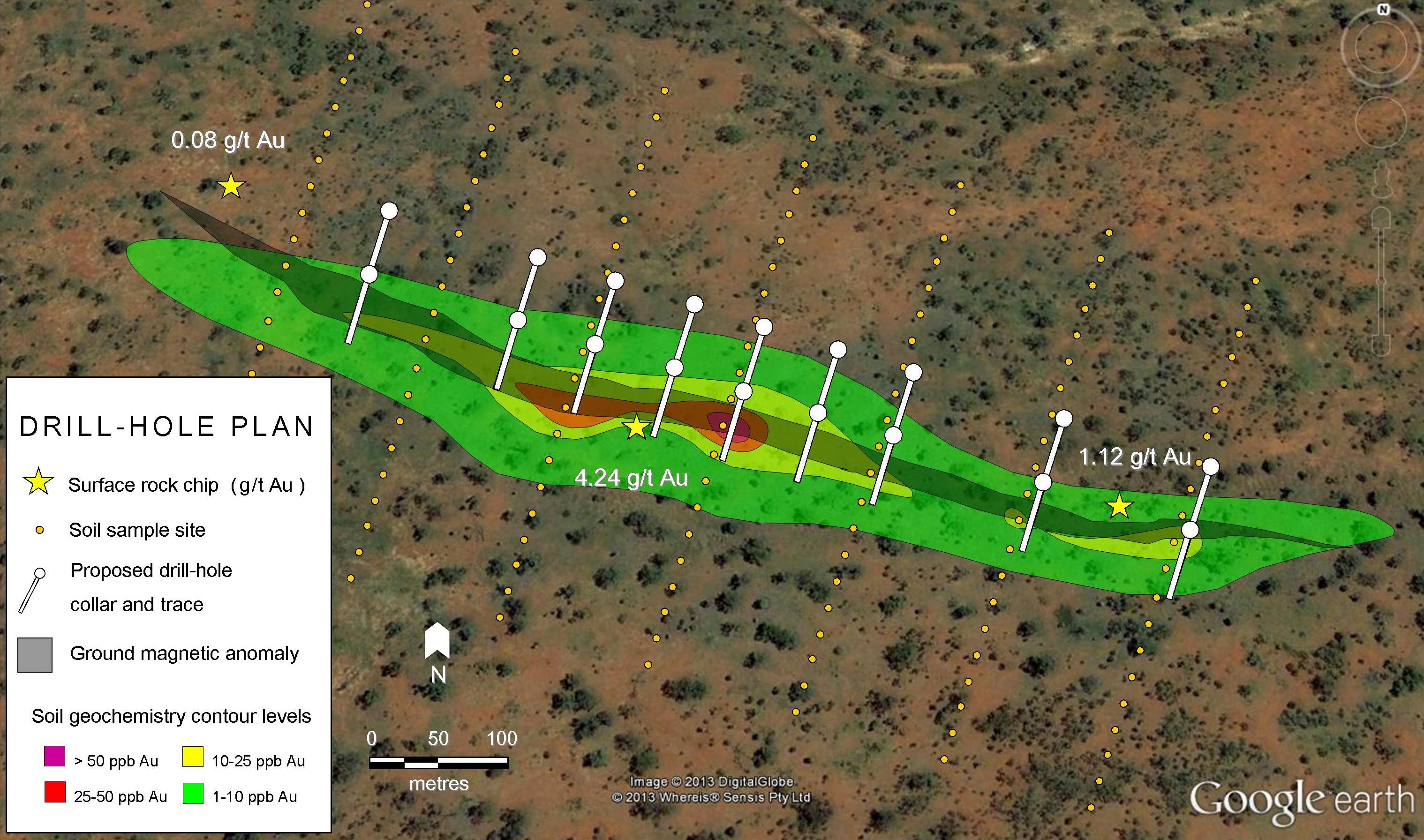
VANCOUVER, BRITISH COLUMBIA–(Marketwired – Sept. 16, 2014) – Kapuskasing Gold Corp. (TSX VENTURE:KAP) (the “Company” or “Kapuskasing”) is pleased to announce that it has commenced prospecting and mapping activities on its Rollo Gold Property. The intent of the prospecting and mapping program will focus on the areas surrounding the historic Hanson Lake and Coppell Gold Occurrences (see July 8, 2014 news release) and will examine large-scale zones of prospective alteration associated with quartz feldspar porphyries, identified by the Geological Survey of Canada. The latter setting is akin to numerous productive gold systems in the nearby Timmins and Kirkland Lake gold camps. Plans are to complete this work prior to snowfall. All samples will be sent for assay at the end of the program and results will be announced when received.
[box type=”note” align=”aligncenter” ]Kapuskasing Gold is a junior mining company actively working in northern Ontario, Canada. The company began as Olympic Resources in 2011 before changing their name to Kapuskasing Gold in February 2014 to help market their work in northern Ontario.
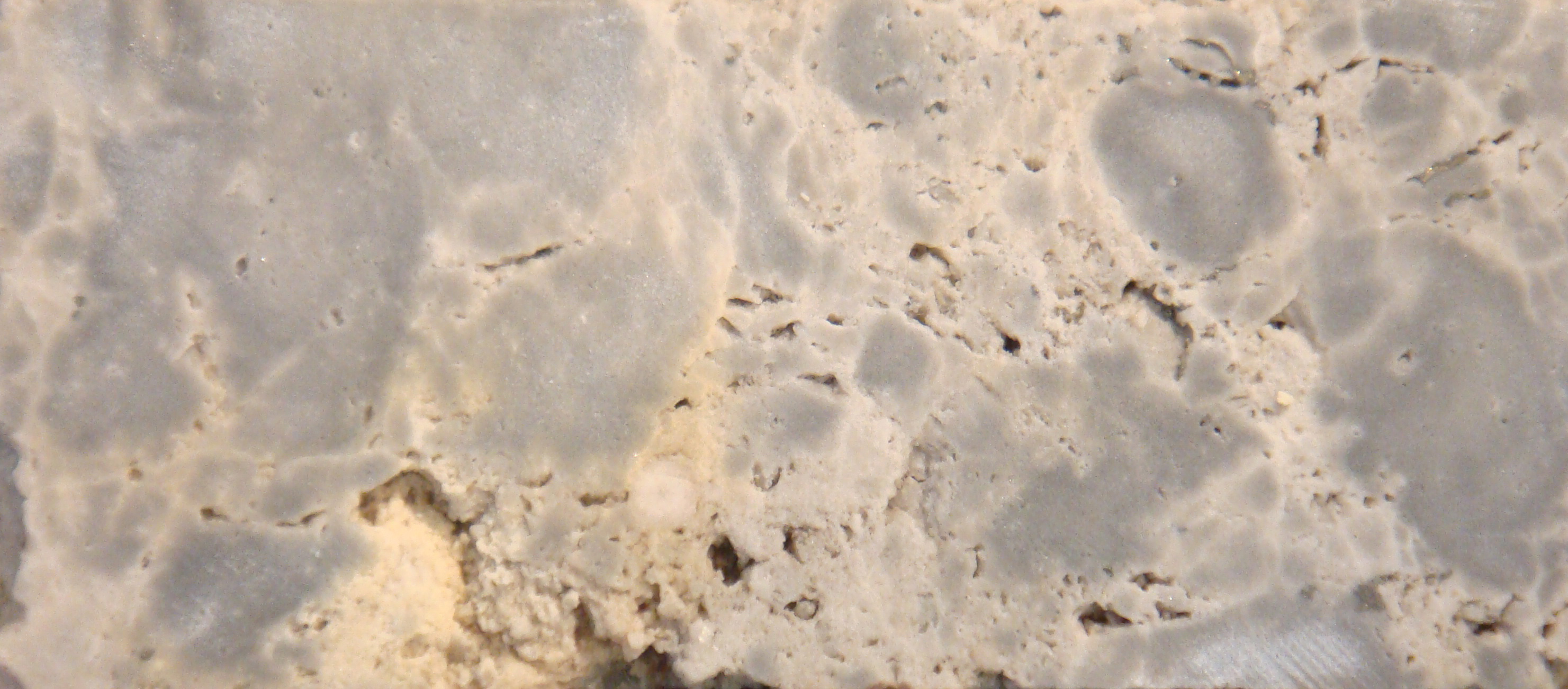
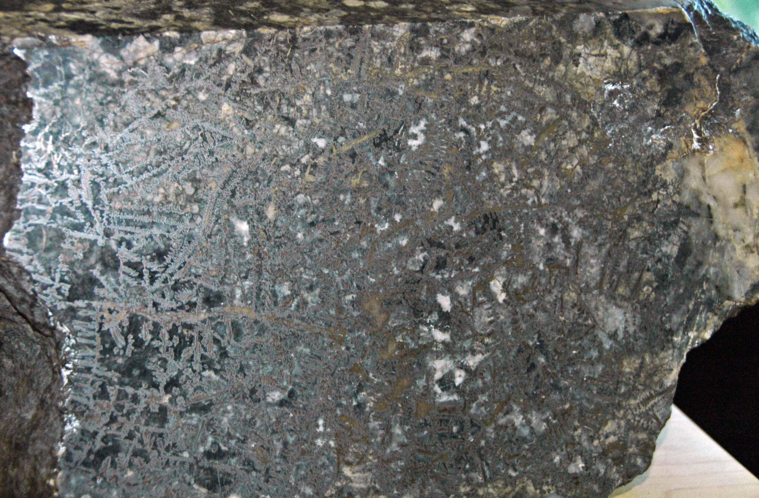
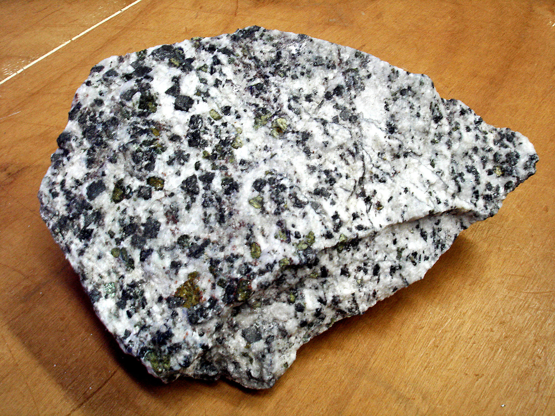
Kapuskasing gold plans on mapping it’s Rollo property in search of alteration “footprints” that are linked to gold mineralization in “quartz feldspar porphyries”. Quartz feldspar porphyries are a type of igneous rock composed of large quartz and feldspar crystals. The property has been described as a “greenstone hosted quartz-carbonate vein deposit”. These veins form as hydrothermal fluids infill faults and joints during periods of local or tectonic activity.
According to a 43-101 compliant technical report filed in April 2014, the property is considered to be a “grass roots”, or very early stage prospect and little previous work is recorded. Previous explorers did note that the area contained very little bedrock exposure and nearly 90% of the area was covered in overburden. The report concluded that a VTEM survey was the best option to identify any conductors in the area. The company has yet to complete this survey but has decided to explore some known gold occurrences based on work from geological survey of Canada report from the early 1950’s.
Properties covered in overburden can be tricky to explore without employing the use of geophysics, shallow drilling or soil sampling methods. With little outcrop exposure and only a few known gold occurrences it’s tough to say if much will come out of a mapping program, but it’s a somewhat obligatory first step in exploration.
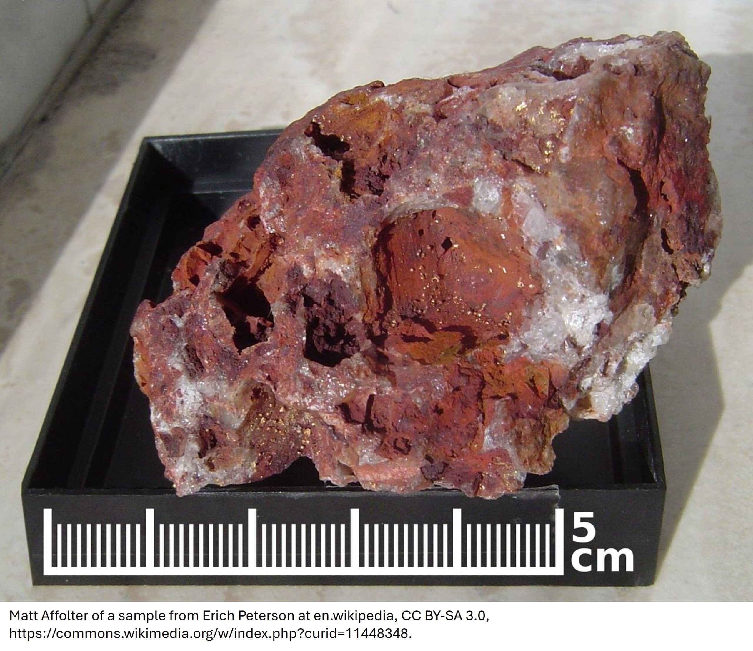
The Blackwater gold deposit in British Columbia is an example of a discovery that required drilling through thick overburden. [/box]
The Rollo property is situated along a projected extension of the Destor-Porcupine fault zone, which hosts several multi-million-ounce gold producers in the nearby Timmins camp, and sits between IAMGOLD’s Cote Lake gold deposit and Probe Mines’ Borden Gold project.
[box type=”note” align=”aligncenter” ]The property is located close to Probe Mine’s Borden Gold project. It always helps to have a well known neighbor to draw attention to a region. [/box]
Ontario Government documents from 1948 and 1950 indicate the occurrence of visible gold mineralization at Hanson and Coppell Lakes. No record can be found of drill testing of these occurrences. The two discoveries are approximately 4 kilometers apart and appear to be located along a corridor of deformation cutting a regional scale fold.
Kapuskasing Gold controls 6 gold properties located along extensions of the Destor-Porcupine, Borden Lake and Kapuskasing structural zones. The Company’s 6 properties surround Probe’s discovery to the north, east, south and west. A detailed map and property descriptions can be viewed on the Company’s website.
[box type=”note” align=”aligncenter” ]Kapuskasing Gold Corp is currently trading at $0.115. They have a one year low of $0.02 and a high of $0.18. [/box]
[box type=”success” align=”aligncenter” ]Have a company or release you’d like us to look at? Let us know through our contact page, through Google+, Twitter or Facebook.[/box]