It would be good to see some information about the proposed drill-holes here. For example, how deep are MAX proposing to drill and are there any specific targets?
[box type=”info” align=”aligncenter” ]Disclaimer: This is an editorial review of a public press release and may include opinions or points of view that may not be shared by the owners of geologyforinvestors.com or the companies mentioned in the release. The editorial comments are highlighted so as to be easily separated from the release text. Please view the full release here.[/box]
VANCOUVER, BRITISH COLUMBIA–(Marketwired – Aug. 27, 2013) – MAX Resource Corp. (TSX VENTURE:MXR)(OTCBB:MXROF)(FRANKFURT:M1D) has received assay results from additional bulk sampling completed at the East Manhattan Wash (“EMW”) gold project in Nevada.
[box type=”note” align=”aligncenter” ]Read more about the East Manhattan Wash gold project here [/box]
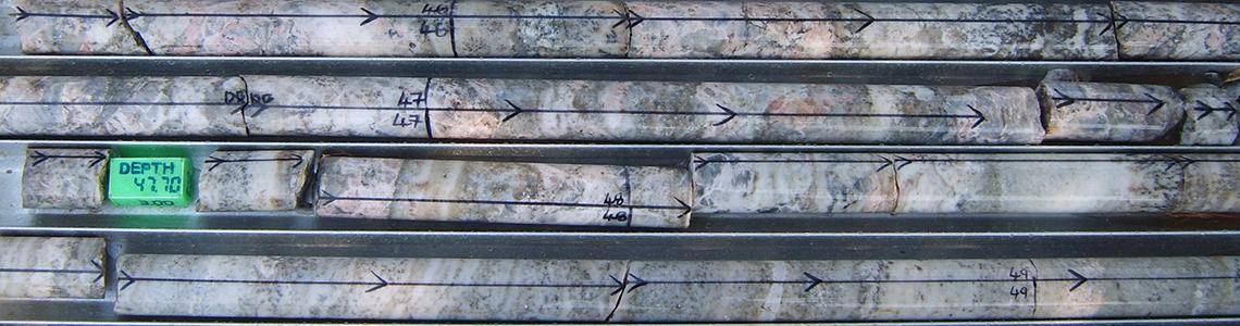
This bulk sampling was undertaken to prepare for drilling planned for this fall by following up on sampling conducted in 2009 that recovered 4.9 g/t Au and 1.2 g/t Ag from a 793 pound sample taken at surface within a gold mineralized soil anomaly exposed over a surface area in excess of 1,650 m by 450 m feet in size.
[box type=”note” align=”aligncenter” ]You might be wondering why such a large sample weight. Well, the reason is to ensure that the sample is representative of the material that you are trying to obtain an assay of. Where a deposit consists of coarse gold, such as at East Manhattan Wash, a large volume or weight of material is required to ensure that the sample is sufficiently representative. Coarse gold gives a “nugget effect” where one portion of sample may contain a piece of gold while another similar size one may contain no gold at all. To get around this issue a large sample is required to ensure that there are sufficient gold particles in the bulk sample to obtain an assay that is representative of the area of the deposit being sampled.[/box]
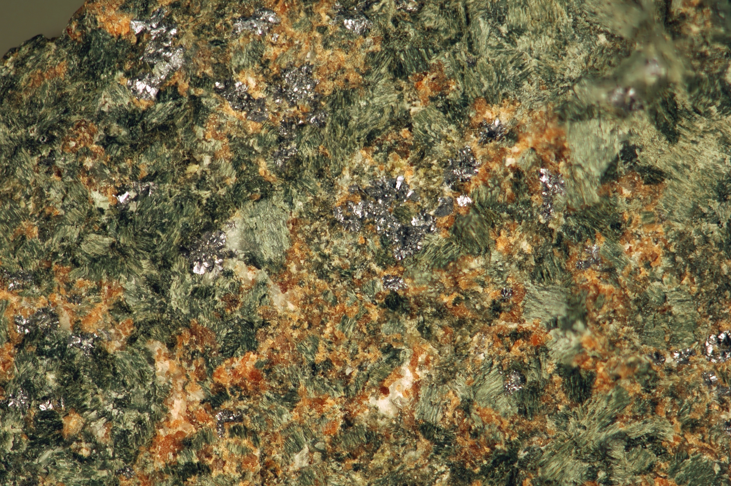
Just north of this area, the very small streams all contain free gold that can be recovered by conventional gold panning techniques. Mineralization appears to be free gold in a volcanic lithic welded tuff. During the current program, two 10 kg samples were taken, one from the same area as the 2009 bulk sample and the second from an area approximately 150 meters to the east. The first 10 kg sample returned 1.5 g/t au and the second sample returned 0.87 g/t Au.
MAX has been advised by the U.S. Forest Service that its drill permit application filed in 2011 should be approved this fall, following which we plan to undertake a 12 hole core drilling program to determine the overall depth and grade of the gold mineralization in the volcanic tuff at EMW.
[box type=”note” align=”aligncenter” ]It would be good to see some information about the proposed drill-holes here. For example, how deep are MAX proposing to drill and are there any specific targets? Refer to our article on drill-hole planning for some background information on the topic.[/box]
Clancy Wendt, VP Exploration of MAX, states, “We have now defined a significant area of gold mineralization that we believe has the potential for a large mineralized system. More important is the fact that the mineralization appears to be free gold within the volcanic tuff which would allow a concentrate to be made on site through crushing and gravity separation, with final processing at toll mills off site. With a large mineralized area now defined at surface, we are anxious to finally be able to drill to determine the overall depth of the mineralization, extend the known mineralization below cover, and determine the overall grade.”
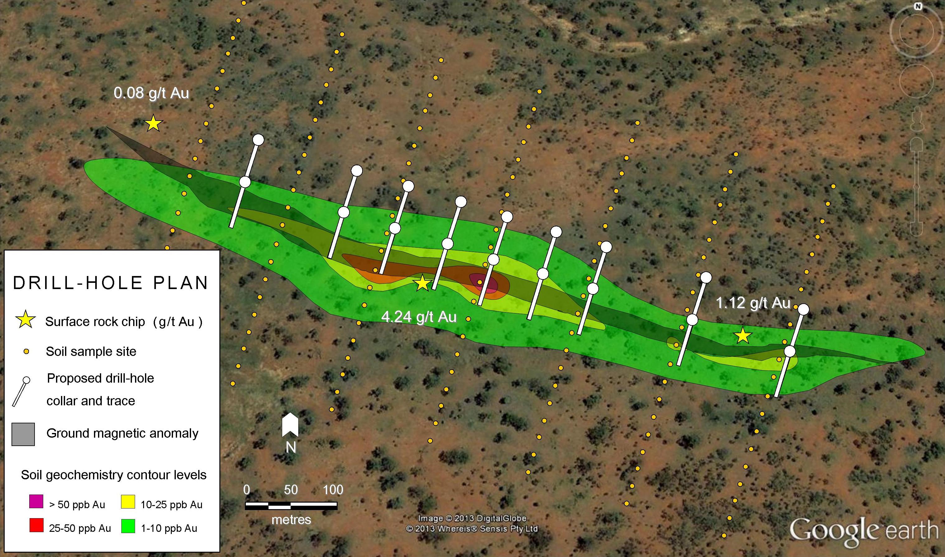
Following up the results of the initial bulk sample in 2009, MAX completed three large volume soil sampling grids in May of 2009 at EMW and followed that up with a further sampling program in September, 2010. In total, over 300 samples were taken and returned values ranging from 0.05 ppm to 1.5 ppm (1.5 g/t) Au. While the total mineralized zone now exposed at surface encompasses an area in excess of 1,650 m by 450 m in size, the mineralized area is believed to be much larger but is covered by either overburden or alluvium. The sampling conducted at EMW has enabled MAX to identify structural linear features seen in air photo images along with argillic alteration and silicification that appears to define where strong gold values may be found.
Sampling of historic pits dug by earlier prospectors has helped further define the areas of mineralization and to confirm the presence of gold. An updated soil sampling map is now available on our web site at www.maxresource.com.
[box type=”note” align=”aligncenter” ]An extract from this soil map is provided here. We have zoomed into the actual survey area to make things a bit clearer. If you need to get up to speed on soil sampling we have written an article which provides a good summary of the method.[/box]
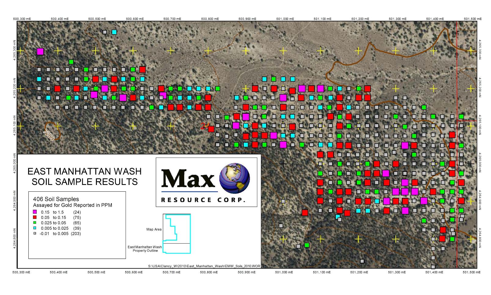
Sampling taken by other companies that reviewed the property during 2010 and 2011 found values up to 2.4 g/t in outcrop. In addition, streams north and east of the soil anomaly were also sampled looking to define the overall size of the system, with all of the streams containing gold with values up to 0.05 ppm. The wide variation in gold values is explained by the presence of coarse free gold in all samples.
The soil and current samples were analyzed by ALS Laboratory Group (Chemex) in Reno, Nevada. Samples from two of the sample grids taken in the coarse gold area (as seen in the previous bulk sample) were run for gold using a one kilogram split with following cyanide leach to minimize the potential to miss the coarse gold. The other grid (different mineralization style) samples were fire assayed in addition to an ICP (Inductively Coupled Plasma) suite of 41 elements. All sample bags were labeled at the site with a sample specific number, logged on a sample card with sample card tag put in each sample bag and taken directly from the field to ALS Labs. In addition, each site was located using a GPS in UTM with NAD 27.
The EMW property is comprised of 78 claims (1,560 acres) located in the Manhattan Mining District 40 miles north of the town of Tonopah and eight miles south of the Round Mountain Mine (jointly owned by Kinross and Barrick), a conventional open pit operation that has produced more than 12 million ounces of gold to date. For 2012, Kinross Gold reported a proven and probable gold resource at Round Mountain (net to its 50% interest) of 64.1 million tonnes at 0.6 g/t Au.
[box type=”note” align=”aligncenter” ]Compared to some of the underground projects we’ve discussed, these grade may seem very low. It all comes down to the cost of extraction: An open pit with heap leach extraction is a very low cost operation.[/box]
More than 1 Moz of gold have been mined to date in the Manhattan Mining District. Production has included the nearby Manhattan mine (1974-1990), an open-pit operation that produced 236,000 ounces of gold at an average grade of 0.08 ounce per ton (“opt”) and the Echo Bay East and West Pit deposits immediately to the west of EMW that operated in the early 1990s, producing 260,000 ounces at an average grade of 0.06 opt.
[box type=”note” align=”aligncenter” ]It is not clear from the press release what the exploration model is. Is it a placer-style wash deposit that is just a surface feature or is it a large strong soil anomaly overlying a major epithermal vein or breccia system? If the latter is true then the East Manhattan Wash area could be a very important and potentially valuable deposit. The coincidence of strong gold values with zones of argillic (clay) alteration and silicification together with the structural linear features seen in air photos supports the epithermal deposit model.
There appears to have been no geophysical surveys done in the immediate area, or if they have been done they are not publicly available. For example, a resistivity survey would show up the silicified zones well, thereby revealing the locations of the mineralised structures.[/box]
This news release has been reviewed by Mr. Clancy J. Wendt, P. Geo, a “qualified person” as that term is defined under National Instrument 43-101.
About MAX Resource Corp.
MAX Resource Corp. is a Canadian exploration company focused on gold, silver and copper exploration in Nevada. Our Nevada properties include Majuba Hill (Copper/Silver) in Humboldt County and East Manhattan Wash (Gold) in the Manhattan Mining District, Nye County.
On behalf of the Board of Directors
Stuart Rogers, President
Neither the TSX Venture Exchange nor its Regulation Services Provider (as the term is defined in the Policies of the TSX Venture Exchange) accepts responsibility for the adequacy or accuracy of this release.
[box type=”success” align=”aligncenter” ]Have a company or release you’d like us to look at? Let us know though our contact page, through Google+, Twitter or Facebook.[/box]