Magnetotellurics (MT)
It sounds a like something from science fiction but magnetotellurics (MT) is just a fancy name for an electromagnetic geophysical technique which is used for measuring subsurface variations in the Earth’s electrical and magnetic fields. The technique can reveal structures and differences in rock types down to a depth of 10 kilometres. Magnetotellurics is used in both petroleum and minerals exploration.
The Earth’s magnetic field is affected by solar activity and lightning resulting in the production of electrical currents below the Earth’s surface. These flows of electricity are called telluric currents. Developed by Russian and French scientists in the 1950s, magnetotellurics has now become an important geophysical technique through recent advances in instrument design and data processing techniques.
An advantage of using magnetotellurics over many other geophysical techniques is the low-impact and unobtrusive nature of the method. The equipment used is light-weight, only natural electromagnetic sources are used and personnel are not exposed to the same hazards as with other geophysical techniques. Consequently, magnetotellurics can be used in environmentally sensitive regions as well as in relatively built-up and inhabited areas.
The technique is so effective because there are large variations in the electrical conductivity of rocks and sediment with different chemistry and characteristics.
Geological structures such as faults can also be mapped using MT because of:
- the juxtaposition of different rock types along a fault, and
- chemical alteration along the fault due to ground water movement The clays formed create changes to electrical conductivity along the fault.
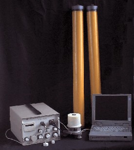
Conducting A MT Survey
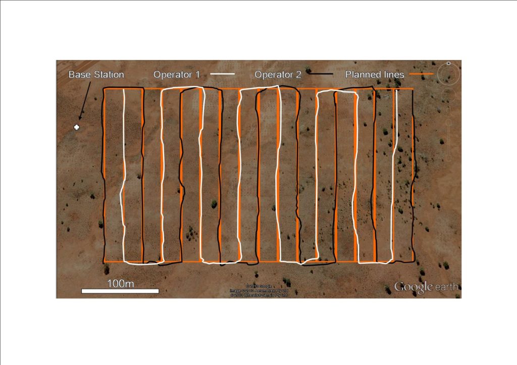
Magnetotelluric readings are recorded every 200 metres or so along a survey line. The line may be designed to cross an inferred fault or suspected change in rock type. At each station along the line electric and magnetic fields are recorded at the same time and also at right angles to each other. The readings are generally taken overnight or for a few days. To obtain information from the greatest depths data may need to be collected for several days to even weeks. This is because greater depths require lower frequencies to be recorded, with correspondingly longer recording times. Another downside to obtaining greater depth penetration is a resultant loss in vertical resolution.
Because the production of telluric currents is dependent on solar activity and lightning, particular times during the solar cycle or certain seasons are better than others. To ensure the best results, the geophysicist in charge of the survey may want to schedule the survey accordingly.
Once the readings have been collected, the geophysicist then processes the data to obtain vertical profiles of the change in resistivity versus depth. The images are then passed onto the geologist who then interprets them and plans where drill holes need to be located.
Controlled Source Audio-frequency Magnetotellurics (CSAMT)
You may have thought magnetotellurics is a mouthful. Well, controlled source audio-frequency magnetotellurics (CSAMT) is even worse! This is where acronyms become really handy.
CSAMT uses a controlled source rather than the natural telluric currents of the Earth. Because of the controlled frequency range of the technique, other man-made sources such as from power lines and electric fences can be filtered from the results enabling high resolution mapping of the subsurface to be achievable. The CSAMT method is a shallower technique than magnetotellurics due to the higher frequencies used. Correspondingly, the data acquisition times are shorter at each station.
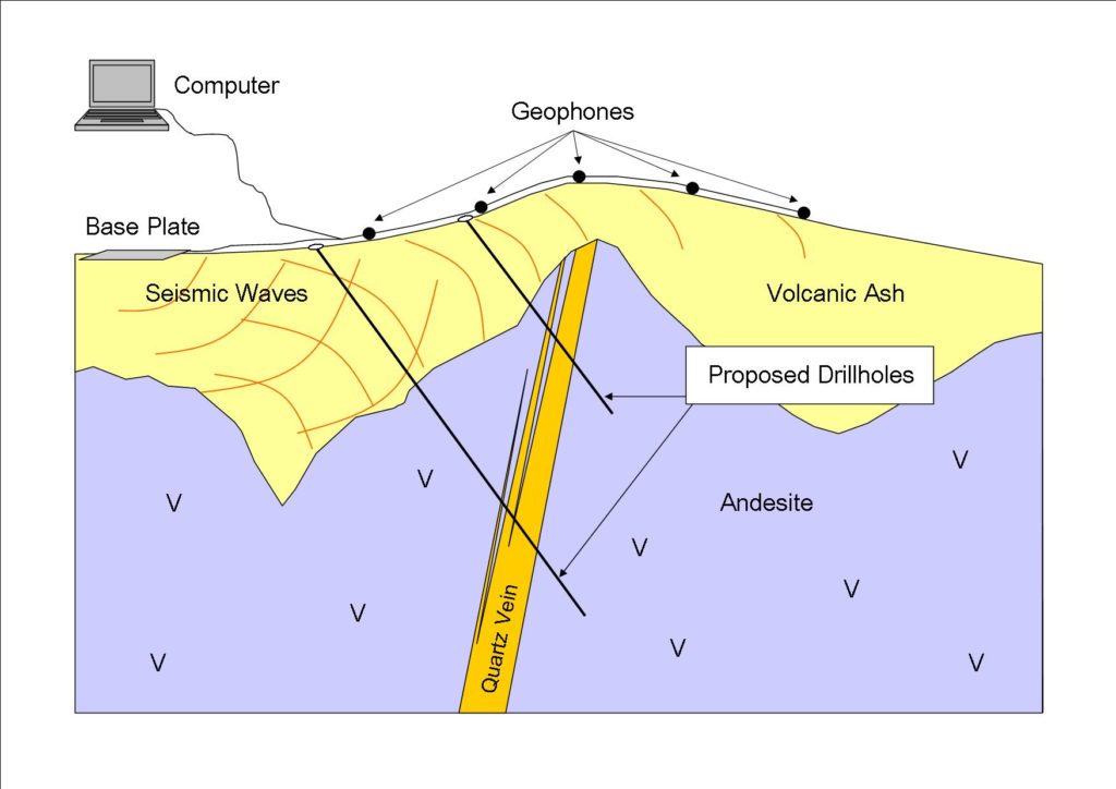
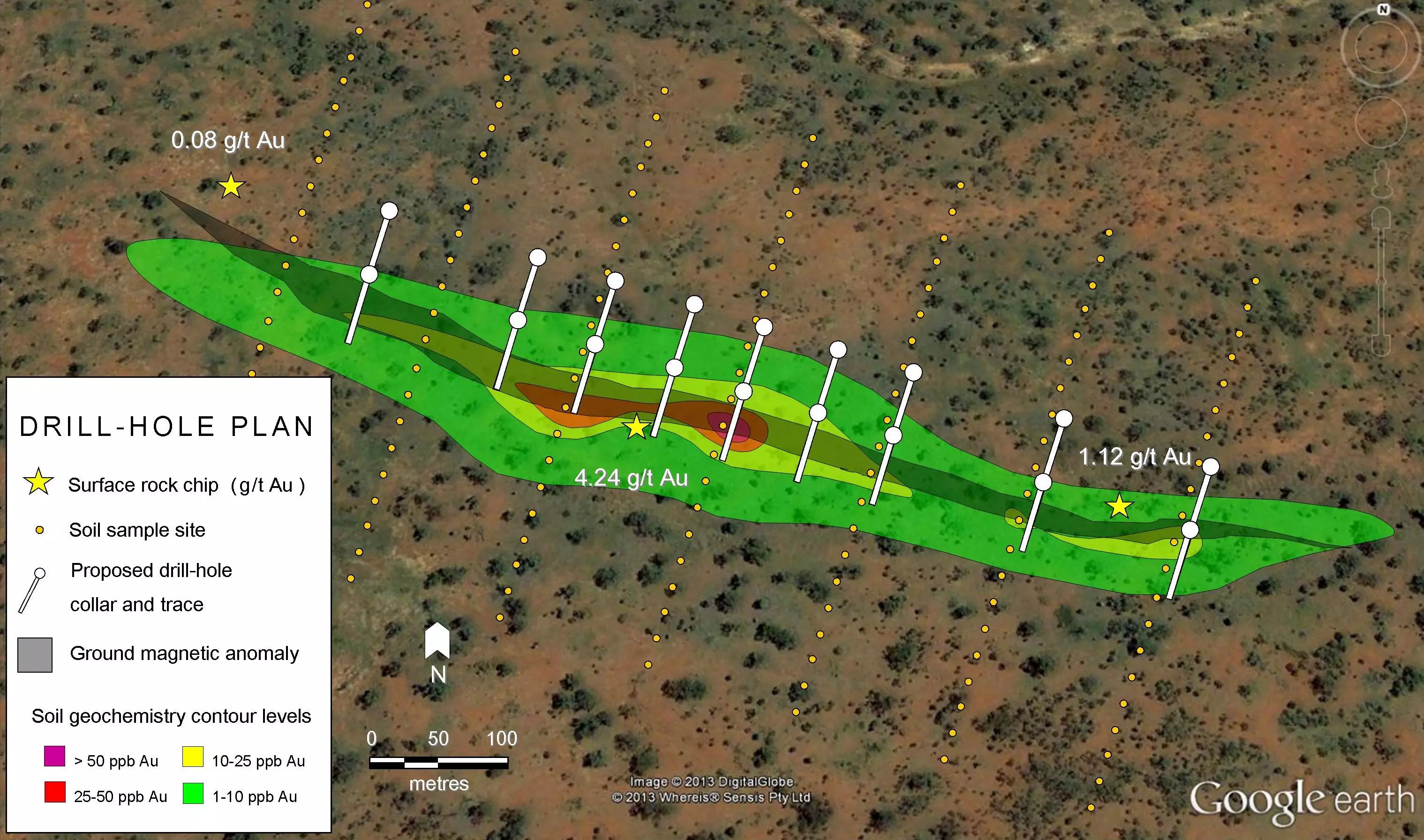
The figure below shows what is possible using CSAMT. Regions of high electrical resistivity possibly associated with a quartz-rich, potentially mineralized zone are revealed using the technique. Highly conductive regions which might represent clay-rich zones, graphite-rich zones or salty ground water within porous rock can also be detected.

Conducting a CSAMT Geophysical Survey
The controlled source or transmitter for CSAMT consists of two 1-metre square aluminium foil electrodes buried in the ground, about 1.5 kilometres apart. These are placed several kilometres from the survey or receiving area. The transmitter line is parallel to the receiver array. The electrodes are connected to a portable generator which produces an electrical current through the ground. Salt water applied to where the electrodes are planted helps with completing the circuit.
At the receiving area a series of small porous porcelain pots are connected by wire to each other forming a line up to 150 metres long. These are then connected to a receiver which records the electromagnetic signals. After the data is collected, the pots, wires and receiver are advanced along the survey line to the next set of stations. The process makes it possible to record information over a 1-kilometre length.
Just like with magnetotellurics, CSAMT raw data is processed by a geophysicist and transformed into resistivity versus depth images which are then later interpreted by a geologist. If enough information is obtained from a number of survey lines, plan view plots or maps of the data can be produced for any depth. From these, three-dimensional models can be produced, which allow for accurate drill-hole design and targeting.