“I am the rich Potosi, the treasure of the world, the king of mountains, and the envy of kings” Charles V Emperor Holy Roman Empire, King of Spain.
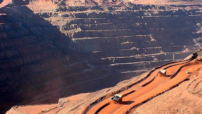
Despite the richness of the deposits, the geology follows a well worn story. A 13.6 million year old, dacite dome was emplaced into the rock above a much larger magmatic source. It had an inner tin-tungsten core, and an outer silver-lead-zinc zone. As the dome slowly cooled, the outer zone was superimposed on the inner zone, and the veins were enriched by repeated fracturing. One source nicely characterized the main stage quartz veins as “strongly developed”. Lightly glaciated, the deposits developed incredibly thick supergene blankets over the veins, with high grade oxide ore extending down 100’s metres. There are 35 main veins and innumerable smaller, side veins. In the early days they were given piquante names like “Vein of the Flemings, or “The Veta Rica” – Rich Vein. Grades of 25-40% silver were reported from these veins, which works out to 7000 to 12,000 ounces of silver per tonne.
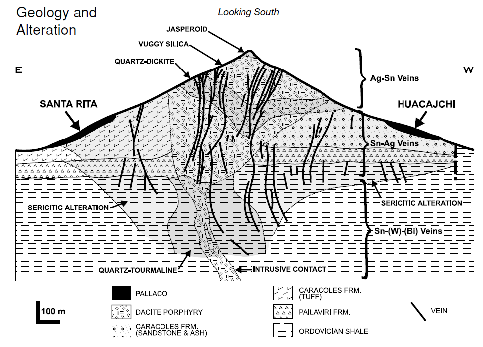
The dacite dome was emplaced into a series of Ordovician shales, which are overlain by a series of Tertiary conglomerates and volcanics. It sits on the edge of massive Miocene caldera, called the Kari-Kari caldera. The mine sequence starts with a large phreatomagmatic deposit, then is followed by an ephemeral lake which sat in the crater. It seems like the dacite did not reach the paleosurface but stopped at the paleo water-table and cooled in place. This cooling formed a hard silica cap, which undoubtedly preserved the deposit, gave the Cerro Rico it’s unique aspect, being a mountain rising alone out the altiplano. The jasperoid and reddish vuggy silica also gave the mountain it’s distinctive reddish hue.
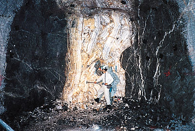
The alteration sequence indicates a high sulphidation environment consisting of a core of jasperoid, vuggy silica,and quartz-dickite alteration surrounded by large sericitic-pyrite halos, overlying the hot quartz-tourmaline alteration at depth. The veins follow a similar pattern with cooler silver-tin to tin-silver to hotter tin-tungsten at depth. The geology of the veins themselves is complex, with multiple pulses of hydrothermal fliuds in a short period time, but the dominant pattern is from hotter fluids to cooler fluids with tin and tungsten minerals coming early, lead-zinc-tin minerals coming after and finally “ruby” silver, boulangerite and pyrargyrite with a common gangue of quartz. The final alteration is late alunite-white clay veins which cut all earlier phases.
How much silver came from this Miocene dacite dome?, the bare minimum is 756,000,000 ounces. That is what was reported to the Spanish authorities and was shipped out to Arica. The unofficial estimates range from 1,000,000,000 to 2,000,000,000 ounces based on the flourishing silver trade through Buenos Aires, and Lima and the amount of other estimated pilferage. Other estimates of metal production and are harder to come by 30,000,000 tonnes of 0.6% tin, and 500,000,000 tonnes at 0.17% tin have been reported . Farther up the mountain above, the reported tin resources a lover grade silver resource was calculated at 143,000,000 tonnes at 167 g/t silver (5.5 ounces) with 0.1-0.25% tin.
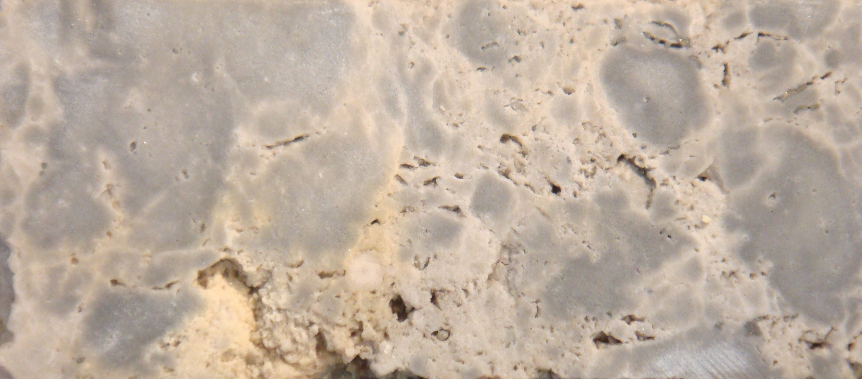
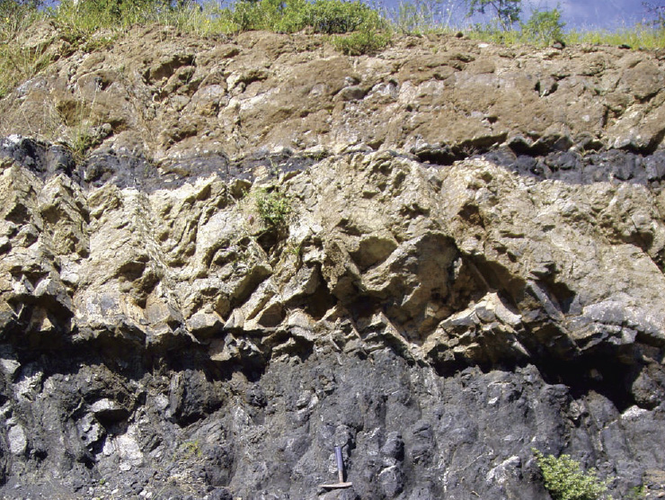
Uniquely due to the lack of glaciation there is a alluvial deposit type found no-where else. It’s called pallacos and it is mass wasting product of the silver veins. As the mountain was eroded, an apron of silver rich gravel developed around the base of the mountain. The deposits range from coarse blocks proximal to the mountain to finer sediments more distal to the mountain. A recent technical report estimated that the gravels covered an area of 5 square kilometres, to a depth 75 metres, but more commonly > 1 metre. They are subdivided into Potosina and Huacajchi type pallacos. The Potosina, have a greater proportion of jasperoid, and are thought to come from a mast wasting event, possibly the initial collapse of the volcanic edifice. The Huacajchi, are thought to have been deposited later, by fluvial processes during intense rainstorms, perhaps linked to periods of glacial climate.
Further Reading
- Sillitoe, R. H., Christopher Halls, and J. N. Grant. “Porphyry tin deposits in Bolivia.” Economic Geology 70.5 (1975): 913-927.
- Strosnider, W. H. J., FS Llanos López, and R. W. Nairn. “Acid mine drainage at Cerro Rico de Potosí I: unabated high-strength discharges reflect a five century legacy of mining.” Environmental Earth Sciences 64.4 (2011): 899.
- Bartos, Paul J. “The pallacos of Cerro Rico de Potosi, Bolivia: A new deposit type.” Economic Geology 95.3 (2000): 645-654
Subscribe for Email Updates