Unless you’ve been hiding under a rock, you know that potash prices have taken a serious tumble within the last year. While this may have killed any number of related projects, it hasn’t stopped these Newfoundlanders from digging in.
[box type=”info” align=”aligncenter” ]Disclaimer: This is an editorial review of a public press release and may include opinions or points of view that may not be shared by the owners of geologyforinvestors.com or the companies mentioned in the release. The editorial comments are highlighted so as to be easily separated from the release text. Please view the full release here.[/box]
ST. JOHN’S, NEWFOUNDLAND AND LABRADOR–(Marketwired – Sept. 16, 2013) – Red Moon Potash Inc. (“the Company” – “Red Moon”)(TSX VENTURE:RMK), is pleased to announce that drilling has been successful in the extending the Captain Cook salt/potash deposit.
[box type=”note” align=”aligncenter” ]
Potash is a potassium salt (KCl) used in fertilizer. You can read more about potash and other evaporite mineral deposits here.
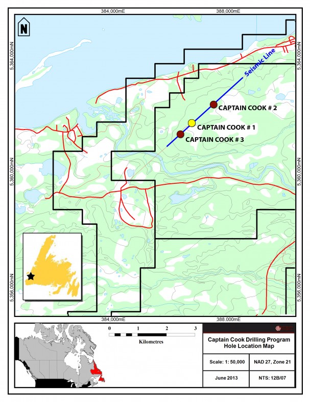
Unless you’ve been hiding under a rock, you know that potash prices have taken a serious tumble within the last year. While this may have killed any number of related projects, it hasn’t stopped these Newfoundlanders from digging in. We’ve included the drill map from Red Moon’s website for reference. They are theorizing that their project is an extension of the same salts mined by Potash Corp in Sussex, New Brunswick.
[/box]
The Company recently drilled two holes in the Captain Cook area, CC #2 is approximately 1000 metres northeast of the potash/salt discovery hole CC #1. CC #3 is 500 metres southwest of CC #1. A drill location map is available at www.redmoonpotash.com
[box type=”note” align=”aligncenter” ]
Note the seismic line. Seismic surveys are heavily used in petroleum exploration and salt deposits are easily identified using seismic due to their high velocity contrast with the surrounding rock. The company appears to have used a petroleum exploration seismic database to identify this prospect.
It is expensive to run geophysical surveys, but there are other ways of obtaining survey data. Oil companies will sometimes sell or license geophysical data to other exploration companies. Depending on the jurisdiction, companies may also be required to publicize surveys after a time. Governments may also perform surveys in order to attract the attention of resource companies.
[/box]
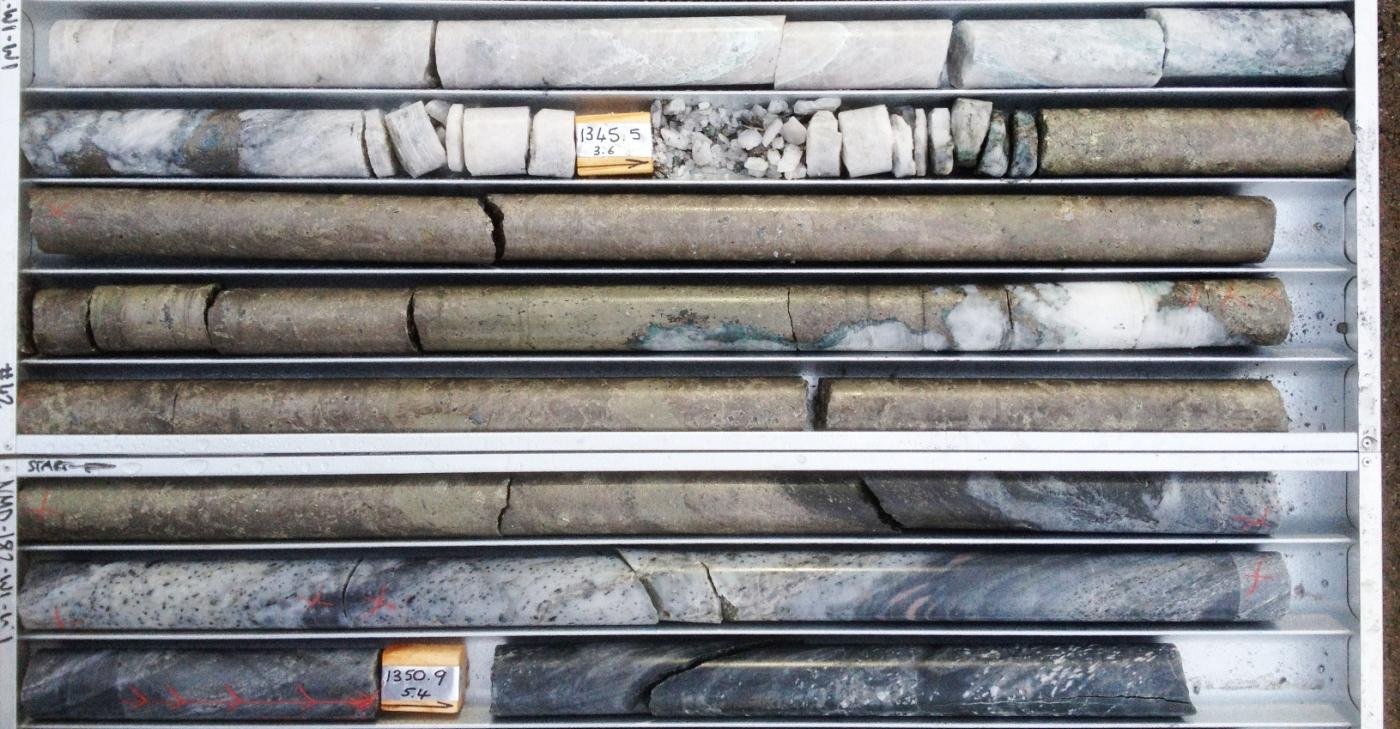
Captain Cook #2 encountered 150 metres (303-453 m) of salt including an upper zone of interbedded red salt, grey salt, mudstone and disseminated sylvite at 318 m – 329 m.
[box type=”note” align=”aligncenter” ]
Sylvite is the mineral name for potash. They have had the core analysed for it’s potassium content (%K2O) and calculated the KCl content based on that result. Red Moon’s highest grade is about 30 cm at 15%, but Potash grades need to be 20%+ to be economic.
[/box]
The most significant potash assays are as follows:
| Sample No. |
Depth (m) |
Thickness (m) |
%K20 | %KCl (Conversion factor 1.58) |
%MgO | %Insolubles |
| CC2-03 | 319.39 319.69 |
.30 m | 1.25 | 1.98 | 0.02 | 1.0 |
| CC2-04 | 319.69 319.89 |
.30 m | 9.53 | 15.06 | 0.02 | 0.9 |
| CC2-05 | 319.99 320.89 |
.30 m | 3.24 | 5.12 | 0.02 | 0.7 |
| CC2-08 | 321.09 321.39 |
.30 m | 2.29 | 3.62 | 0.03 | 2.4 |
The upper zone is interpreted to correlate with the main upper zone at CC #1. The lower concentration of potash at CC #2 indicates it is located distal from the main potash evaporatic event. For context, the CC #1 results were as follows:
[box type=”note” align=”aligncenter” ]
The two most recent holes were a follow-up to CC#1 shown below. Not particularly encouraging since the potassium values are are still mostly sub economic in CC#1.
[/box]
| Depth (m) |
Thickness (m) |
%K2O | %KCl | %Mg | %Insoluables |
| 278.6 279.1 |
0.5 | 7.27 | 11.51 | 0.01 | 1.1 |
| 279.6 279.8 |
0.2 | 9.34 | 14.79 | 0.01 | 1.5 |
| 287.8 288.4 |
0.6 | 20.4 | 32.29 | 0.02 | 1.8 |
| 288.8 289.5 |
0.75 | 5.79 | 9.17 | 0.05 | 1 |
| 290.8 291.1 |
0.3 | 4.44 | 7.03 | 0.29 | 0.9 |
| 291.8 292.2 |
0.4 | 7.91 | 12.52 | 0.05 | 1.3 |
| 328.5 328.6 |
0.1 | 10.1 | 15.99 | 0.03 | 1.5 |
CC #3 encountered 70 metres of salt (225m – 295m) including a zone of interbedded red and grey salt with minor sylvite at 275 m – 280 m. Neither sample analysed returned greater than 1% K2O.
[box type=”note” align=”aligncenter” ]
Though Red Moon has managed to find some large salt intervals they have not found any potash in CC#3. The task for them now will be to go back to their geophysics and see if they can correlate the use data from these drill results with the geophysics and find some more promising targets.
[/box]
CC #2 and CC#3 extend the salt basin over a width of approximately 1.5 Km in a north – south orientation in the Captain Cook area. Each hole intersected the potash zone near its depositional margins where potash development is less mature than at CC#1. They were located to the test the extreme margins of potash distribution along readily accessible drill locations in a north and south direction. The most prospective sites in the Captain Cook area for potash remain to the east and west of CC #1 along the geologically interpreted depositional centres where potash development is anticipated to be concentrated. The next round of drilling will test these locations. It is anticipated that 6 – 8 holes will be required to test the potash potential of the area.
The cores from CC #2 and CC #3 will now be sampled for NaCl (salt) concentrations. Salt analysis at CC #1 was very encouraging with a high grade zone of 32 metres (220m-252m) of NaCl exceeding 96% purity. This occurs in a wider interval of salt exceeding 160m in thickness. Results from the salt analysis on CC #2 and CC #3 will be released when available.
[box type=”note” align=”aligncenter” ]
200-300 meters is pretty shallow. By comparison, the Sussex mine in New Brunswick is mining around 500-700 meters.
[/box]
The core analysis reported in this release was performed by the SRC Geoanalytical Laboratories of Saskatoon, Saskatchewan. All core samples were acquired, sampled, packaged, labelled and transported by or under the direct supervision of company personnel. Patrick J. Laracy, P.Geo., President and Corwin Northcott, P.Geo., Exploration Manager, are qualified persons responsible for the contents of this news release as defined in National Instrument 43-101.
The Company gratefully acknowledges that the drilling project has been supported financially by the Province of Newfoundland and Labrador through the Junior Exploration Assistance Program with a minimum grant of $60,000 and potentially up to $100,000 depending on the ultimate availability of funds in the program.
Red Moon is a junior exploration company focused on potash/salt exploration in western Newfoundland. Vulcan Minerals Inc. (TSX VENTURE:VUL) owns approximately 60% of the common shares of Red Moon and owns a 3% royalty on the project lands.
[box type=”note” align=”aligncenter” ]
The fairly thick and shallow salt intervals may make this more of a salt play than a potash deposit. Time will tell.
[/box]
[toggle title=”We’ve skipped some of the boilerplate. You can read it in here.” state=”close” ]
The TSX Venture Exchange has not reviewed and does not accept responsibility for the adequacy or accuracy of this release. This release may contain certain forward-looking statements. Actual events or results may differ from the Company’s expectations. Certain risk factors beyond the Company’s control may affect the actual results achieved. Accordingly, readers are advised not to place undue reliance on forward-looking information. Except by law, the Company undertakes no obligation to publicly update or revise forward-looking information.
Shares Issued: 38,000,004
[/toggle]
[box type=”success” align=”aligncenter” ]Have a company or release you’d like us to look at? Let us know though our contact page, through Google+, Twitter or Facebook.[/box]